
3D Trail Maps
I love hiking and mountain biking, but between college and other obligations I’ve had a hard time getting out to ride. This got me thinking… what hobby could I do in pockets of spare time that would remind me of my favorite rides?
That’s where I got the idea of creating 3D printed trail maps! I download public elevation data, overlay my favorite trails, add some text, and print out physical maps.
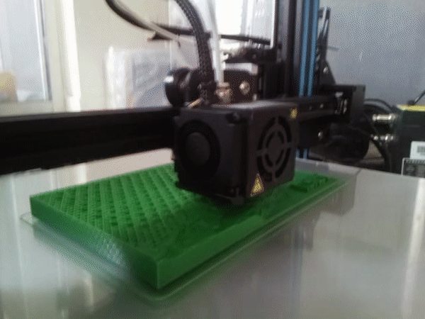
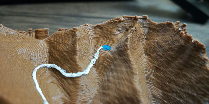
They print with a raised impression of the trail which I then paint, so you can both see and feel the path of the trail. I also make a pass through in a vector image editor, smoothing out the gpx tracks and using my memory of the trail to make them as accurate as possible.
Check out a few of the maps I’ve made so far below!
- Tiger Mountain*
- Hansen Ridge*
- Mason Lake*
- Rachel Lake
- Snow Lake
- Tokul
* I’ve shared this model on Thingiverse, link in description.
And if you like them, feel free to reach out! I’d be happy to make more if you’re interested.
The elevation data I’m using has a resolution of 1/3 arc-second, or about ten meters, so short trails or those with low elevation gain won’t turn out nice. But upscaling this data to look nice blown up is on my to-do list! (Which due to work and school is an unfortunately long list for the time being…)
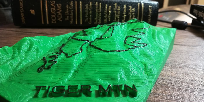
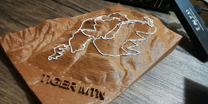
Tiger Mountain
Tiger Mountain is one of the most popular trail systems near Seattle. My favorite trail here is Predator, but I’m biased because this is the first major trail projects I’ve worked on and I spent many hours working on it while I was looking for work after moving to Seattle.
I’ve shared this model on Thingiverse

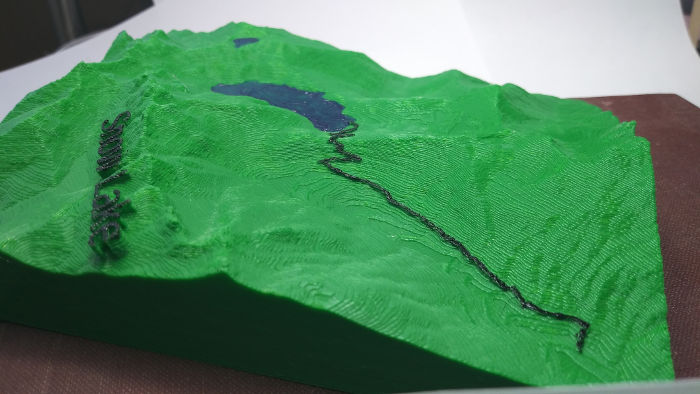
Hansen Ridge
Hansen Ridge is by far my favorite cross country ride anywhere. It’s a reversed lollipop loop along an exposed ridgeline with a cool lake at the end. Maps don’t do it justice, but in 3D you can get a feel for the scale of the ridgelines and epic views you’ll experience here.
I’ve shared this model on Thingiverse

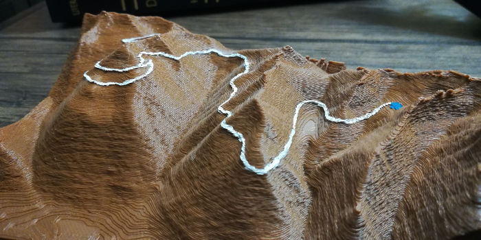
I also decided to push the limit and see how small I could print these!

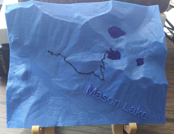
Mason Lake
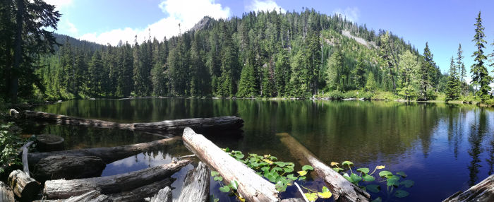
The Ira Spring trail is a fun 7.5 mile hike that takes you to Mason Lake, a small alpine lake sheltered by a ridge. It’s a nice place to camp or just hang out, and the exposed ridgeline on the way up makes for incredible views!
I’ve shared this model on Thingiverse.


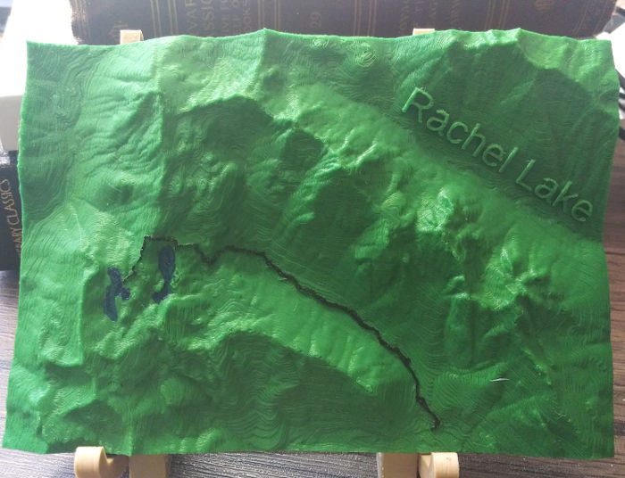
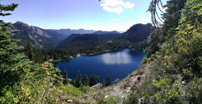
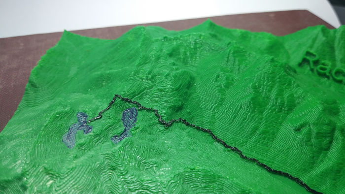
Rachel lake
The trail to Rachel Lake starts out gradual then quickly gets steep. Rachel Lake itself is a great destination, but if you continue on another mile or so you’ll find yourself at Rampart Lake.
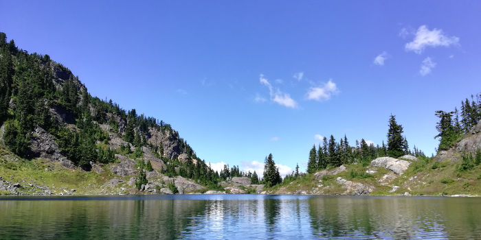
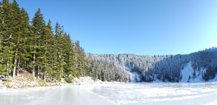
Snow lake
Snow Lake is a huge alpine lake that’s easy to get to. The trail is only three and a half miles long, starting out at the Alpental parking lot and continuing mostly flat until a few mild switchbacks at the end climbing up over a ridge and down to the lake. As the name suggests, it’s a great snow hike!


Looking down into the lake from the ridge.

Standing in the lake. You’ll have to imagine the view…
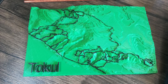
Tokul
Tokul is a fun trail system, but the model is still a bit of a work-in-progress as the elevation gain is relatively small. I need to interpolate the data to add finer elevation steps and figure out how to draw Bezier curves on raster images or matrix data.
I’ll add more pictures in the future as I make more maps!